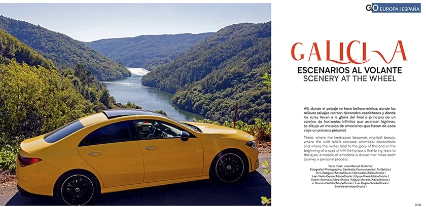
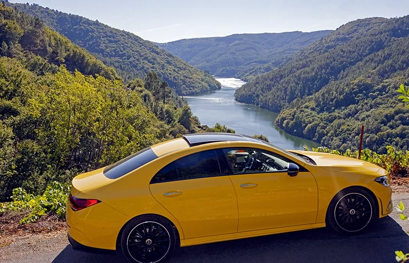
There, where the landscape becomes mystical beauty, where the wild reliefs recreate whimsical decorations and where the routes lead to the glory of the end or the beginning of a road of infinite horizons that bring tears to the eyes, a mosaic of emotions is drawn that make each journey a personal process.
Galicia is a scenario halfway between the real, the mystical and the mythological, where you can climb mountains that touch the stars, sail through river canyons with your eyes agape, lose yourself in pristine and almost deserted beaches or melt into the most dreamy nature.
The landscape also speaks of the bond created with its people since time immemorial, who have been wisely carving the land according to the needs of the moment, giving us such beautiful pictures as the terraces of the Ribeira Sacra, the fertile orchards cared for with care, the mosaics of meadows that invite you to let yourself go, the fishing villages and towns adapted to the environment and so many paths and roads along unique itineraries that transform each stop and journey into an initiatory process towards a living, rich and multifaceted reality.
A suggestive way to enter “the country of a thousand rivers”, as the Galician writer Álvaro Cunqueiro called it, is to follow one of the twenty-five unusual routes through the most beautiful Galician landscapes.
Endless sea
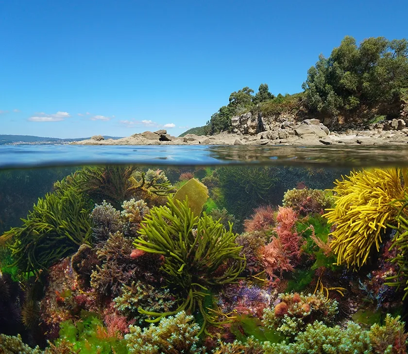
The Galician coast will leave you speechless. You will feel the force of the sea or the ocean as you approach the vertiginous cliffs that can reach up to six hundred metres in height and you will be moved by some of the most beautiful sunsets you can imagine, you will connect with the land as you step barefoot on endless or wildly secluded beaches, your mind will fly between Celtic ruins, fishing villages, nature reserves and, like an old sailor returning, you will travel along the roads from lighthouse to lighthouse.
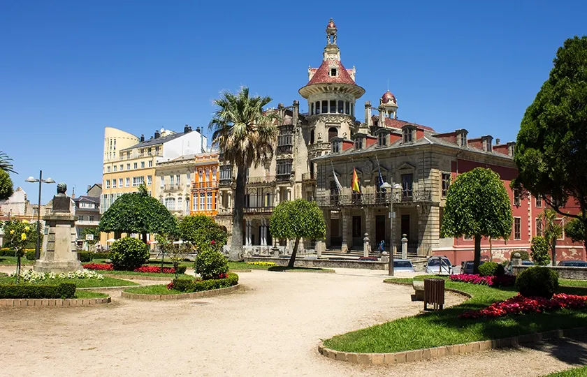
A Mariña Oriental de Lugo has one of the most unique coastlines in Galicia, where you can find villages of Indian architecture such as Ribadeo, hamlets and towns, farmland and mountains. Overlooking the Bay of Biscay, there is a succession of sandy beaches, with the beach of As Catedrais standing out.
The coastline of Ortigueira and Mañón has some of the most impressive cliffs of these dangerous coasts, harbouring ports that shelter pleasant villages, as well as open sea beaches, the maritime observatory of El Semáforo, natural viewpoints, heritage and fishing villages such as Ortigueira or the charming O Porto do Barqueiro.
Cliffs, spirituality, fog and mountains are some of the charms of the route between Cedeira and Cabo Ortegal, a sample of the landscape and ethnographic values of Galicia. An itinerary that, in many of its sections, is a continuous viewpoint over the Atlantic Ocean from some of the highest cliffs in continental Europe.
From the castle of A Palma to the castle of A Nogueirosa, the Golfo Ártabro is a maritime arc formed by the estuaries of A Coruña, Ares-Betanzos and Ferrol, which the Roman geographers called Portus Magnus Artabrorum. The Real Villa de Mugardos and its castle of A Palma, Ares or Pontedeume stand out, settled by the sea for their mild climate and the seclusion of their quiet beaches.
The Corne and Laxe estuary, in the heart of the Costa da Morte, offers a route where the land unites what the sea separates. With the estuary of the river Anllóns as an intermediate point and Monte Branco as a continuous visual reference, the route between the lighthouses of Laxe and O Roncudo offers different perspectives of an estuary small in size but great in beauty.
The mythical Costa da Morte looks bravely at the Atlantic, while the strength of the wind, the smell of the sea and the green of the mountains define the essence of one of the most dangerous coasts in the world. The circular route starts and ends in Camariñas and takes us to coastal villages, coastal landscapes, dunes, headlands and sandy beaches, reflecting the stories of sailors.
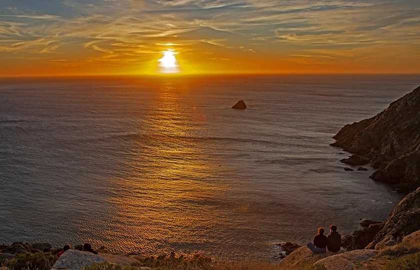
Fisterra symbolises that extreme place where the land ended. In this case it is the beginning of the beautiful route along the coast, passing by mythical places of the Costa da Morte: Corcubión, Cee, the Xallas waterfall, among other landmarks, until reaching the spectacular end at the viewpoint of O Ézaro on Mount Pindo, the sacred Olympus of the Celts.
The surroundings of Corrubedo, famous for its unique dune, have much more to offer. It is one of the best preserved stretches of coastline in Galicia with extensive sandy areas, dune systems and mountains from which to contemplate the Atlantic beauty in its purest state. Baroña is an obligatory stop and a visit to the castro from the 1st century BC and 1st century AD, located on a small isthmus above the beach of Arealonga.
The route from Cape Udra to Cape Home connects the natural areas of the south of the Pontevedra estuary with the north of the Vigo estuary along the Atlantic continental façade of the O Morrazo peninsula, with a view of the Atlantic Islands National Park. This fantastic route passes through the Aldán estuary and combines the representative values of the Rías Baixas: nature, good weather and beaches.
In the surroundings of the Vigo estuary, several natural viewpoints offer excellent panoramic views of the coastline and the Atlantic Islands National Park. Monte Cepudo starts the route towards the Monte Aloia Natural Park through the amazing Sierra de O Galiñeiro, connecting the Rías Baixas with O Baixo Miño.
The route along the southern coast of Galicia allows you to travel along a unique stretch of coastline. The road that links Baiona and A Guarda is one of the most beautiful scenic itineraries of the coast; a long straight line parallel to the sea through Historical Sites or the mythical castro of Santa Trega, in the company of the amazing mountain range of A Groba.
Valleys, rivers and mountains
Galicia enchants from the first glance with the green tapestry that covers it, imbuing the journey with a bucolic emotion that is always longed for from a distance. The region’s hinterland is the sum of natural and cultural values that have been passed down from one generation to the next, forging an identity and a genuine way of life.
Between A Fonsagrada and Negueira de Muñiz, the valleys follow the mountains in a continuous up and down. The turns of the road offer a great variety of perspectives through which the Primitive Way to Santiago passes. The mountain landscape contrasts with the deep valleys in which crops and villages are hidden, also visible from imposing viewpoints such as Arexo.
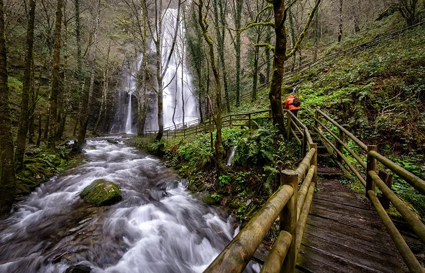
The wide extensions of Os Ancares allow for a complete tour of its passes and valleys between Navia de Suarna and As Pontes de Gatín. A mythical place in the Galician mountains, its overflowing nature, abrupt orography and secular isolation have favoured the conservation of a rich and genuine ethnographic heritage.
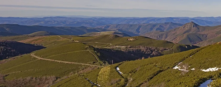
The Pilgrims’ Routes to Santiago de Compostela connected Galicia with Europe for centuries and continue to do so. Among the various variants, the French Way is the best known, with O Cebreiro being the point of entry into Galicia. This itinerary to Samos shares the route of the first Galician stages of one of the most important pilgrimage routes in the world.
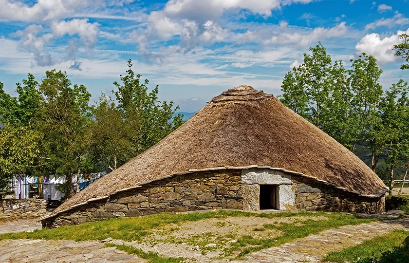
The Sierra de O Courel is one of the mythical territories of Galicia, the natural and spiritual reserve of the Galician people. With its biodiversity it forms some of the most beautiful postcards of this corner of the world. The landscape that seems unreal and that can only be explained when it is perceived in first person.
The Ribeira Sacra del Miño is one of the great wine-growing areas of Galicia, whose landscape combined with the lush vegetation and the presence of a rich Romanesque legacy create an exuberant ensemble. Starting from Chantada you can enjoy an itinerary that runs along the banks of the river, with a surprising end in Os Peares where the Sil and the Miño decide to join together.
The Ribeira Sacra starting from Monforte de Lemos is another alternative to get to know one of the landscapes with the most character. The geographical particularity of the Sil River Canyon is associated with a unique climate that gives relevance to the vineyards and forests. Its rich cultural heritage completes everything you need for an unforgettable trip.
The south-eastern part of Galicia is a succession of valleys and mountain ranges that form different environments, ranging from the high mountains of the Trevinca area to the wine-growing landscapes of Valdeorras and the Mediterranean nuances of the Serra da Enciña da Lastra Natural Park between A Veiga and the Penedos de Oulego.
The Bibei River flows through the province of Ourense until it reaches the Sil. The route crosses the Terras de Trives between rocky walls where historic vineyards grow. Starting from A Pobra de Trives, it descends to A Ponte Bibei, the greatest exponent of the Roman heritage in the area, looking for the surprising final destination: the sanctuary of As Ermidas on the rocks.
The journey from Montederramo to Manzaneda through the Massif Central of Ourense is an experience for the senses. The impressive mountain ranges, the colours of the suggestive vegetation and the rhythm of silence offer a relaxing journey through small villages and one of the best preserved landscapes and the only mountain resort in Galicia: Manzaneda.
The surroundings of A Gudiña, the south-eastern gateway to Galicia, is a territory of old roads, rugged and sparsely inhabited. Part of the route coincides with the Sanabrés Way to Santiago along the Seca mountain range to the mountains of O Invernadeiro. Going up the river Conso is a spectacle of waterfalls and streams to the final destination in the hidden village of Pradoalbar.
The Roman legacy is very present in A Baixa Limia. The rich imperial heritage in these lands, together with the extraordinary natural and scenic values make this route a suggestive experience along the historical itineraries through the O Xurés mountain range that give way to Portugal in Portela do Home.
The Miño is an essential river in Galician geography and culture. The route follows its valley from Ourense, the city of water, to Ribadavia, among the wine landscapes of the region of O Ribeiro. The route combines heritage, natural and aesthetic values through lands of Roman heritage and Mediterranean climatic features.
The O Suído and O Cando mountain ranges form the southern sector of the so-called Dorsal Galega, a mountain range that crosses the centre of Galicia from north to south, halfway between O Ribeiro and the Rías Baixas. This itinerary is surprising for its landscape, its unique heritage and the cultural contacts with America, the result of migratory processes.
The central regions of Galicia from Aciveiro to Carboeiro present a rich legacy of natural and heritage values. Livestock farming regions that maintain a well-preserved landscape, successions of valleys that coexist with mid-mountain areas, such as the Sierra de O Candán, and bewitching monasteries that take us back to other eras.